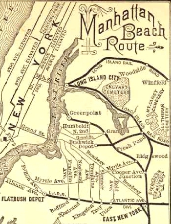
1884 Route Map of the New York and Manhattan Beach railroad, showing the Greenpoint segment of track.
In the late 1800s, a railroad stretched from Greenpoint to Ridgewood. Join me on a expedition uncovering surprising traces of this route.
The Broad Strokes
The Glendale and East River Railroad (G&ER for short) was formed on March 26, 1874. They procured a right of way that today runs from just south of Greenpoint, across the industrial areas of ‘East Williamsburg’, to a location called ‘South Side Crossing’. Here, the G&ER tracks crossed the modern day Bushwick Branch freight track at Varick Avenue. The tracks east of here later became known as the Evergreen Branch, and continued through Ridgewood to a connection at Cooper Avenue Junction to tracks that eventually lead down to Coney Island.
A better way to describe this route is via an actual map – so I created this one.
This article covers the tracks from Bushwick Inlet (on the upper left) to ‘South Side Crossing’ at Varick Avenue. The blue line represents the route, while the parallel yellow (east of South Side Crossing), denotes when each section of the Evergreen Branch was abandoned.
Unlike the elevated railways of Manhattan, the G&ER ran right along the ground, similar to Brooklyn’s trolley lines – only this railroad had a specific ‘right of way’ (ROW for short) separated from most streets, running right through the middle of many present day blocks. Trains started running on May 16, 1878.
One unfortunate construction decision was the use of cheap ‘narrow gauge’ tracks. A ‘narrow gauge’ railroad is, as the name implies, significantly more narrow in width than standard railroad tracks. These tracks also tend to be lighter, and not able to support the weight of a standard sized train. The G&ER was reportedly built with 40lb rail, where standard railroads use rail that is more than double that. This necessitated the use of specialized narrower train cars and lighter locomotives. The company was soon merged into the New York and Manhattan Beach Railroad, which operated trains to Coney Island from the much more popular ferry terminal at Long Island City. A push was made to modernize the tracks from Cooper Junction to South Side Crossing with standard gauge track. This section of track became known as ‘the evergreen branch’, and served primarily freight customers. The route north and west of South Side Crossing was abandoned in 1896 – a mere eight years after it opened. One can only assume it had lower ridership than the LIC terminal, and the cost of upgrading to standard gauge track wasn’t viable.
The few historians who have previously written about this route all seemed to believe that there was no trace at all left of the tracks from Greenpoint to South Side Crossing. I, however, am a pretty stubborn fool, and insisted on tracing this route myself. Much of the route is indeed long gone, but if you look really closely, and dig into property records, there are still a few surprising clues.
Retracing the route
In October of 2016, I retraced the route of the tracks from Greenpoint to South Side Crossing. I honestly wasn’t expecting to see much.
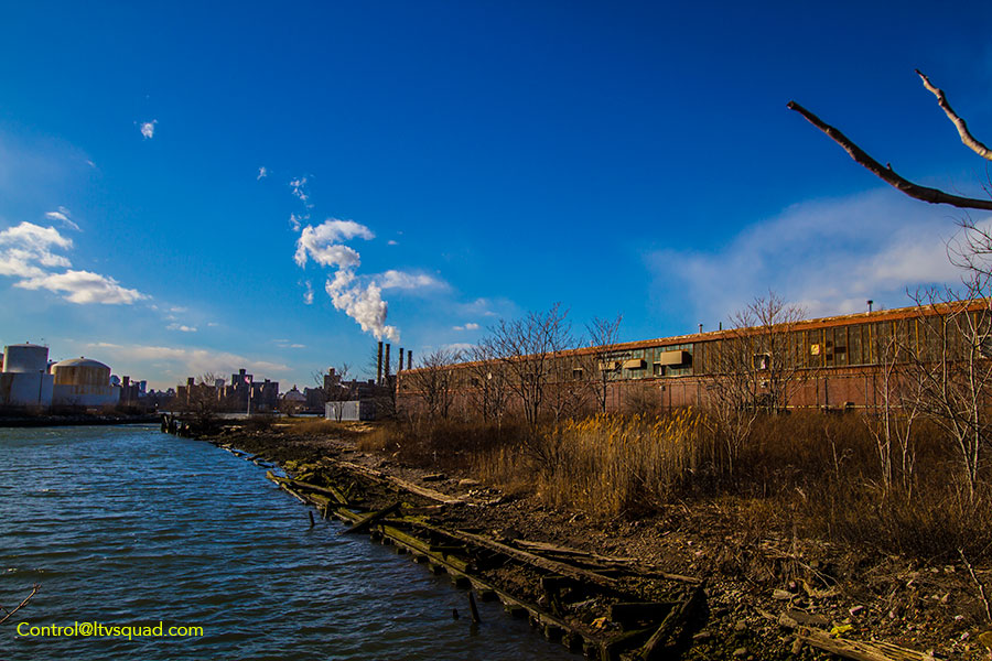
This Property was once the main waterfront rail yard for the G&ER
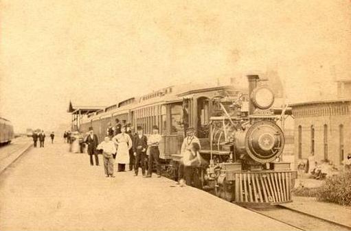
This photo is believed to have been taken at the Greepoint Terminal.
Starting at the former yard in Greenpoint, the former terminal site is a beat up property with a concrete pier crumbled into the water, and a thick coat of weeds and trees. If there are still any tracks or trace of railroad in this ground, it’s under a layer of dirt and debris. Someone with a metal detector might have better luck finding something here than I did. They’ll have to act quickly though – the property is slated to be cleaned up as part of the long promised, decades long bungled, Bushwick Inlet Park project. Work has not been scheduled (so far as I know) on this clean up, but time is short.
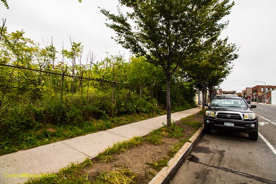
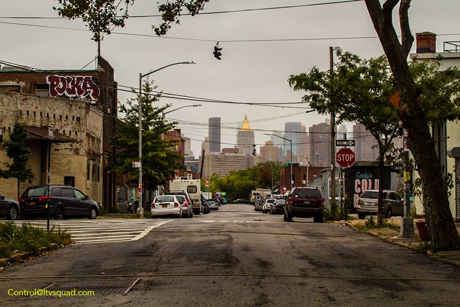
Exiting the former terminal heading east, the tracks ran down 15th street. This street of course has been paved over many times since the 1800s, so there’s no trace of the route to be found here. Nor can one find any trace of it at the Automotive High School, which was built directly on part of the route, or through McCarren park or McCarren Pool. As with most NYC history, there isn’t even a historic marker in place.
Along Kent Avenue
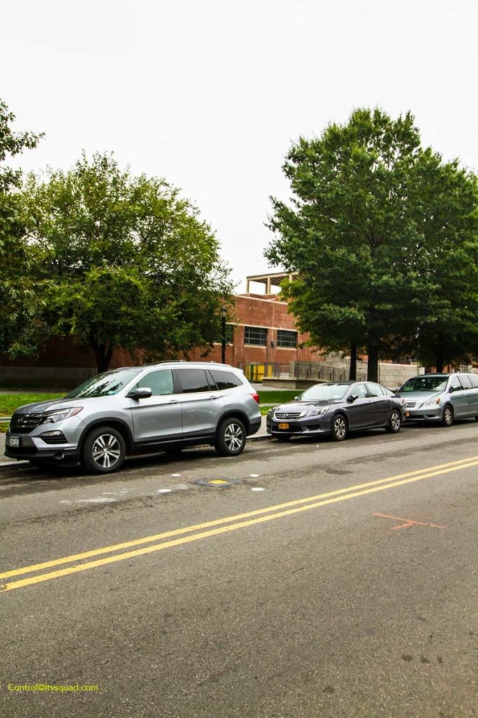
North 15th street, facing west. The tracks would have passed right down the center of this street.
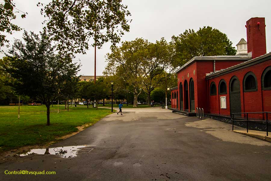
The tracks would have passed directly through Automotive High School (just beyond the trees) and in front of the bathrooms at McCarren Park
Facing East, the right of way is also completely wiped clean by McCarren pool
The Plot Thickens
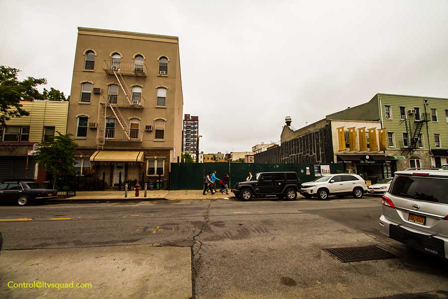
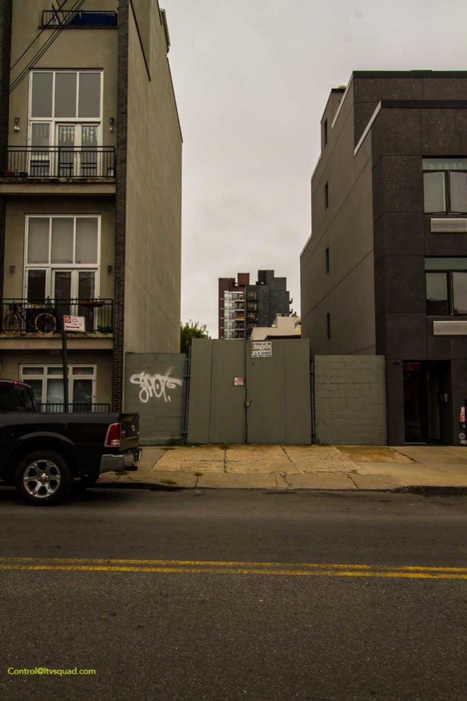
Things get interesting at Leonard street. Located directly along the route, I found an odd triangular lot. The line of the building to the north is specifically angled against where the track would have run – a not uncommon sight in areas where buildings were specifically designed to wrap around or run right up against railroad sidings. Now, of course the building on this plot was built long after the G&ER ceased to exist, but the visual clue is uncanny. This couldn’t just be a coincidence. A little bit of research proves me right. Looking up tax map records, I found this lot is separated from its neighbors, and apparently never built upon. There’s probably a pretty interesting story or three on how this plot of land has remained undeveloped, though I’m not quite sure where I’d research that bit. The old growth tree that is this lots only resident likely started to grown sometime after the rails were removed. Long live the G&ER tree!
The G&ER tree
This tiny plot of land somehow remained undeveloped after the G&ER was abandoned.
Looking west towards Greenpoint Terminal. With a little imagination you can almost picture the track running straight ahead.
Break Out The Tax Map
Now, you might dismiss this lot as a fluke, but let’s trace the rest of the nearby route, running east between Richardson and Frost streets. Here, the tax maps show much of the property as an odd linear lot running right down the center of these blocks. There are no neighboring blocks divided in this very unique manner. That’s not all though: the architecture of surrounding buildings also tell the story. Here, you’ll find many old wood framed homes, with newer buildings that were built much later, on the properties that were part of this train route.
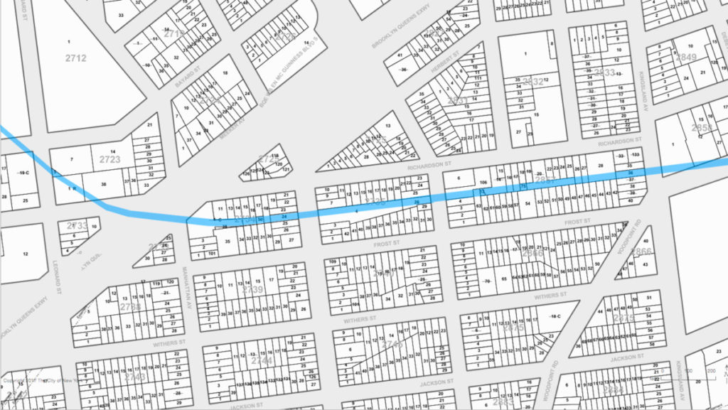
G&ER route highlighted in Blue. Note the linear property lots running behind the homes on Richardson and Frost Streets. Only a few of these tax lots of been merged with neighboring lots over the years. A few, specifically the lots in the center of the block with no street frontage, are specifically mentioned as ‘vacant land’. One of these lots measures a mere 25 feet in width.
Did this lot on Manhattan Avenue remain undeveloped as it sat on the former G&ER right of way?
Facing east across Graham avenue, the former right of way was a vacant construction site in October of 2016.
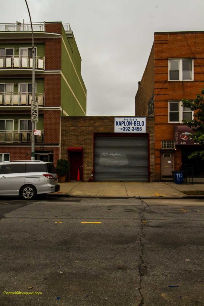
Facing west from across Graham, this small garage building is entirely out of character with it’s neighbors. It was built in 1976. Also, could the crease in the pavement indicate an old iron track buried below? Unlikely, but certainly suspect! One can usually find such pavement deformities where iron is buried under asphalt.
Looking through the construction site fence facing East on Graham Avenue, one can see how the right of way went directly behind buildings on the block, whose backyards abutted yet did not encroach on the former track property.
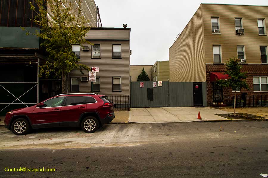
Down on Humboldt street we see another out of character modern building construction directly on the former right of way. It was only built in 2007, while both of it’s neighboring buildings date to 1928 and 1930. (There’s a record for 1927 building existing here – so this stark visual might just be the byproduct of the current NYC real estate overdevelopment boom)
And on Kingsland Avenue, we find yet another undeveloped lot along the former right of way. No building ever seems to have been built here. Sometimes, ‘undeveloped’ lots such as these can be the result of the original owners not capitalizing due to a variety of issues – amongst them being an owner such as a railroad that isn’t vested in property development, or a bank that hasn’t gotten around to selling the property.
The Trail Goes Temporarily Cold
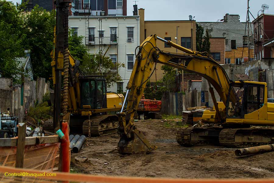
East of Kingsland avenue, all hope seems lost. The housing projects and warehouses from here to grand street are all products of 1900s construction. Likewise, there seems to be no trace at all of the bridge that carried the railroad across Newtown Creek. The entire property from the creek to South Side Crossing is now one massive Dept. of Sanitation facility, where household trash from North Brooklyn is loaded into freight cars destined for out of state landfills.
Into the housing projects, where no trace of the route can be found.
Again down at Metropolitan and Grand Streets, no trace of the route can be found.
Behold, The Evergreen
Across the creek and down on Varick avenue, at the location formerly known as South Side Crossing, we come across our first set of remaining tracks – the standard gauge freight tracks of the Evergreen Branch. Here is were you’ll want to click through to Part 2 of this story, where I trace the route of the Evergreen, whose memory and relics are only now truly fading to oblivion.
Enjoyed this post? Give us a little love over on Patreon, and gain access to exclusive content.

LTVSquad.com is the blog of NYC's most notorious team of explorers. We bring you a unique roasted blend of content culled from the fringes and dark underbelly of this fine city. Consider us an Autodidact's guide to urban exploration and adventure.
Privacy PolicyAll content on this website is copywritten, and actively tracked. If you steal it, you will be found and face very expensive settlement costs. To license any content on this website, contact us.
Outstanding work. I have been fascinated by this line for a few years now, and I have done some work on the Evergreen Branch wikipedia page and other related pages. Your great research has shown some mistakes in the articles and you have found some traces of the line that I didn’t know still existed. Thanks so much. This website is great, and this work is important as rich developers scavenge the city, looking for undeveloped real estate to build their luxury apartments, and thus, removing traces of old New York. Keep up the great work. You should really write a book with photos detailing the old rail right-of-ways in New York.
Wow – Cool – I actually was going to link from here to the wiki pages after going in and making an edit or two. Your write ups are really well maintained & helped point me in the right direction for a few bits. I was pleasantly surprised by it since there’s not nearly enough about these disappearing parts of NYC history. With the Evergreen, I was amazed that so many lots along the ROW still haven’t been built on. I’m sure that’ll change in the years to come.
I cannot find enough words to praise you for taking the time to trace the rail line from the East River when others said there was no trace of it. Most importantly, your comprehensive research yielded information that others were unable to recognize. It would be nice if a plaque was placed in the riverfront park when completed indicating the presence of the railroad. Perhaps you have contacts in the Parks Dept. with decision making authority.
would anyone have pictures of the yard at putnam ave ?i have contact The PRR Group and the long island rail museum.
Where is the video of Phantom Trainride on the Evergreen Branch? I can’t find it anywhere and it was a great video to watch.
I am forever a New Yorker having moved west in 1959, but still follow many stories like this. Can’t visit the City enough and although I will never have time to look this area as you did I truly enjoyed reading about it. Thanks
wow, you saved the world!
Thanks so much for this article. When I chaired the Land Use Committee of CB 1, we reviewed an interior lot that exists between Humboldt and North Henry St.; this was the POW for the old railroad. When we discussed this with the local residents, we were told that they had, over the years, uncovered old rail ties and other relics of the old line. Also, the new building at Humboldt St. was once a vacant lot that, while attached administratively to the old hospital building to the left, was actually a separate city lot. About 10 years ago, I conducted a walking tour that traced the old Bushwick Creek, which ran along roughly the same course as the train line. I was able to talk about both during the tour. Thanks again.
I grew up in Flushing in the 60s and lived there thru 82.
Anything on the lines running off the LIRR to Willets Point and College Point/Whitestone?
That route is definitely one I want to trace sometime.
Thank you. Brooklyn was always a mystery for this Bronx-bred boy.