NYC Industrial Map Initiative
June 18th, 2013 by Bad Guy JoeIt is with great pleasure that I announce our new NYC Industrial Map Initiative.
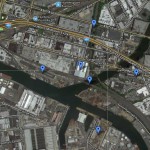
At the very heart of this initiative is a map which shows 50 NYC area industrial locations - the majority of which are factories that no longer exist. Each pin on the map brings you a detailed write up and photos accumulated over our 20+ years of exploring NYC industrial buildings. I have personally gone back and researched each location, adding significantly more historic information than we have published in the past, in addition to replacing hundreds of small photos with much larger ones. I hope you find these write ups to be eye opening and full of forgotten bits of NYC history as I have while researching them.
At the moment it is probably best to click here and view the map in a new window/tab. Be sure to zoom in on clusters of pins, and out to see everything. Currently the furthest North pin is in Yonkers, while the furthest south is in Red Hook. (Don't worry Staten Island, you'll have a few pins soon).
There are still many locations and historic write ups in the works, and we may very well start adding pins to write ups contained on other sites. The goal of this map is purely to enlighten everyone to the thick history of NYC that is often hidden in plain sight. This map will grow over time. Keep an eye out for more and more pins to drop in the weeks, months and years to come.
Let us know what you think, and definitely feel free to share any bits of information you may have on any of the locations listed on the map. Simply use the comment form at the bottom of each write up. The idea is to build a strong library of knowledge regarding the various factories that once thrived all across NYC.


